- Data : 2014-2017
- Link di Riferimento : https://cordis.europa.eu/project/id/620400
- Coordinatore : Consiglio Nazionale delle ricerche
- Partners : Politecnico Di Milano (It) Universidad De Zaragoza (Es);Aed-Sicad Aktiengesellschaft (De) ; Lup-Luftbild Umwelt Planung Gmbh (De) ; Instytut Geodezji I Kartografii (Pl) ; Brgm - Bureau De; Recherches Geologiques Et Minieres (Fr) ; Srp Gesellschaft Fur Stadt-Und Regionalplanung Mbh (De) ; Centre National De La Recherche Scientifique Cnrs (Fr) ; Trilateral Research & Consulting; Llp (Uk) ; (Geokomm) Verband Der Geoinformationswirtschaft Berlin/Brandenburg (Geokomm); Ev-Association Of The Geoinformation Industry Berlin/Brandenburg (De) ; Regione Del Veneto (It) ; Alkante Sas (Fr) ; Association Francaise Pour L'information Geographique (Fr) ; Depth; France Sas (Fr) ; Global Infotech (It) ; Trilateral Research Ltd (Uk)
European Network for Redistributing Geospatial Information to user Communities - Open Data (Head CNR-IIA)
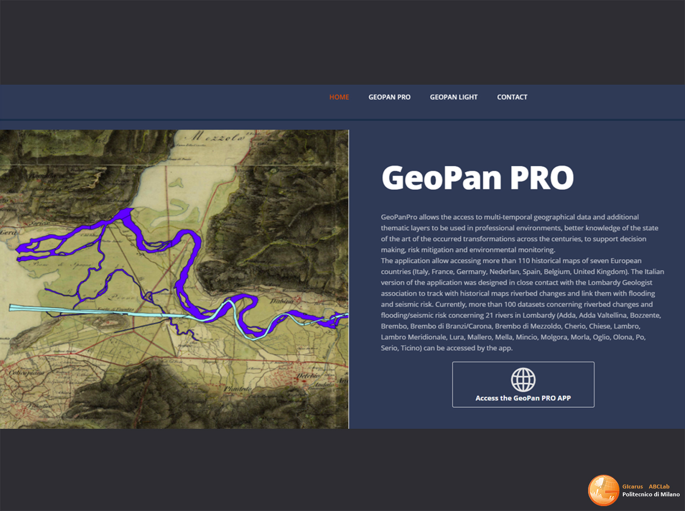
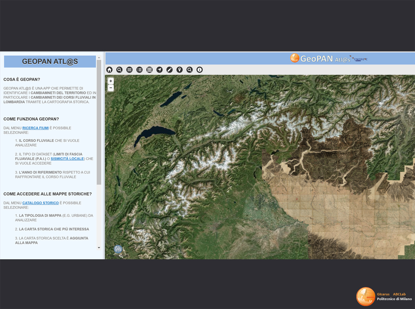
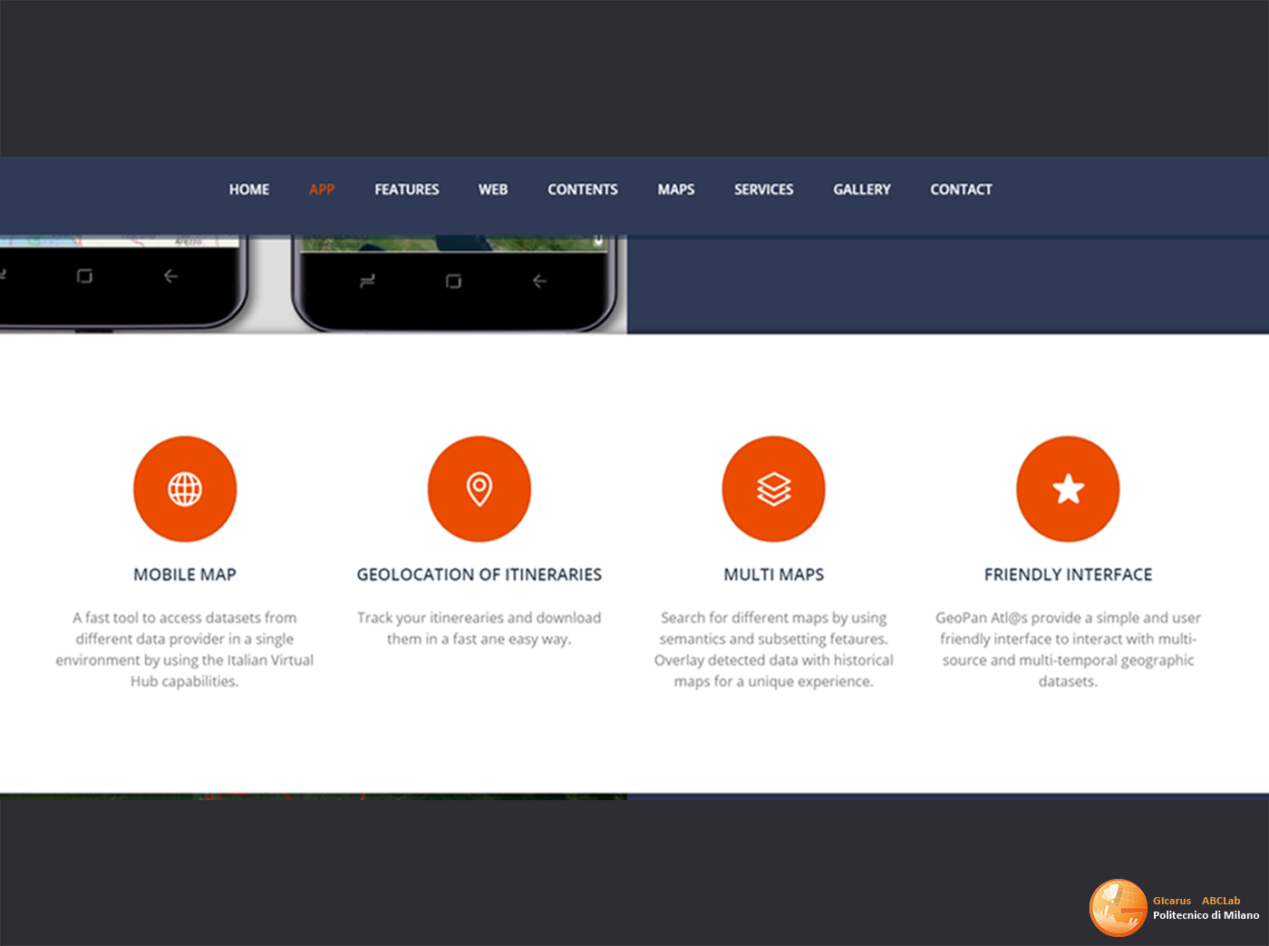
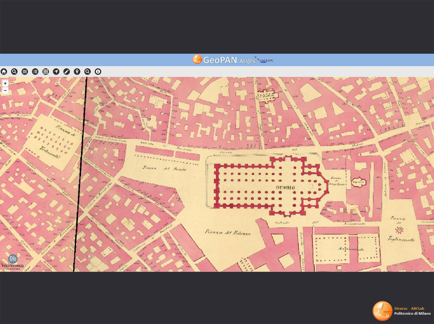
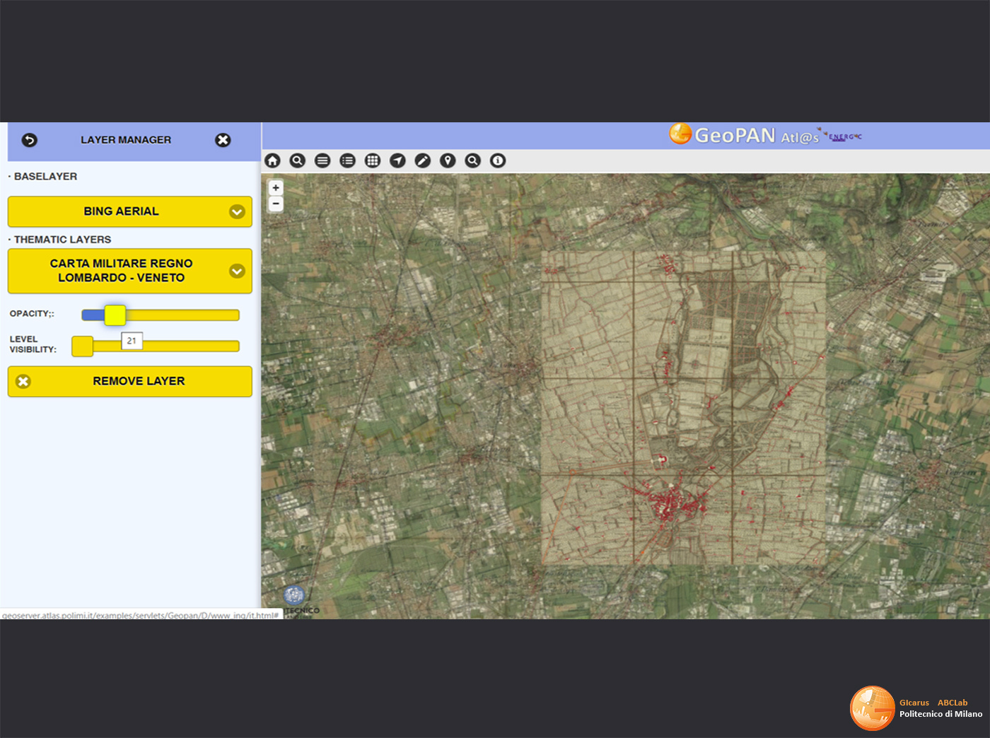
CIP-ICT-PSP.2013.2.2a - Open data – Open data experimentation and innovation building on geographic information, CIP-ICT-PSP-13-7 Theme 2 - Digital content, OD creativity. Polimi PI R. Brumana, in charge for GEOPANAPP implementation, Multisource OD-GOD access&semantic profiling. POLIMI PI. Awarded by the EC-ICT Radar Innovation. GEOPAN APP Polimi PI R. Brumana, in charge of GEOPANAPP implementation, Multisource OD-GOD access& semantic profiling. L’applicazione “GeoPAN APP” (Energic OD), sviluppata per mobile e desktop, permette di identificare i cambiamenti del territorio, in particolare dei corsi fluviali in Lombardia, grazie all’impiego della cartografia storica e di Open Data della Regione Lombardia. L’applicativo è stato sviluppato con il contributo di O.G.L. (Ordine Geologi Lombardia) Awarded by the EC-ICT Radar Innovation. Research Team : R. Brumana, B. Cuca, M. Previtali, D. Oreni, L. Barazzetti, F. Banfi Link GEOPAN APP http://geoserver.atlas.polimi.it/examples/servlets/Geopan/D/www/it.html http://geoserver.atlas.polimi.it/examples/servlets/Geopan/dashbord/production/Introduction.html http://geoserver.atlas.polimi.it/examples/servlets/Geopan/dashbord/production/user_manual.html GeopanAtlas APP platform implementation (Architectural Components: Open Layer, WTS, and others). 3Terabyte capability: Geoportal open source Infrastructure, source test website Infrastructure for multi-temporal Geodata access and sharing map series and HBIM repository; Typo4.4.5, Geoserver, WMTS, A360. GEOPAN-APP managing GEODB HUB discovery and access to open data. Hosting Server POLIMI-ASICT. Hosting GEO Virtual Hub Server and GEOPAN APP (POLIMI-ASICT): an Open Source semantic-based Infrastructure developed to manage Open Data, linked data, and Geographical Open Data using the Italian Virtual Hub (CNR-IIS) for the GeopanAtlas APP implementation (Architectural Components: Open Layer, WTS, and others).